SRT Bike Overnight

This is actually the second time I’ve done this little trek. The first time was in the waning days of 2022. I rode on December 30th and camped overnight to wake up on my 50th birthday, December 31st, in my tent to a brisk day and a wonderful campfire. I have been yearning for another ride, and I’m terribly out of shape, so I put in for a day off and snuck away for a Sunday to Monday bike overnight.

When I first did the research on this route, I knew I needed to find a place to park my vehicle overnight. The wonders of the internet, and especially the cycling community, never cease. After posting my dilemma in a Facebook group for bikers in Philly, a generous gent named Kevin offered his driveway up to me, and he lives just off the trail near Norristown, PA. Both last year and this year Kevin rode with me for the first 20 miles or so of the trip. So fun to meet fellow cyclists and stay in touch!

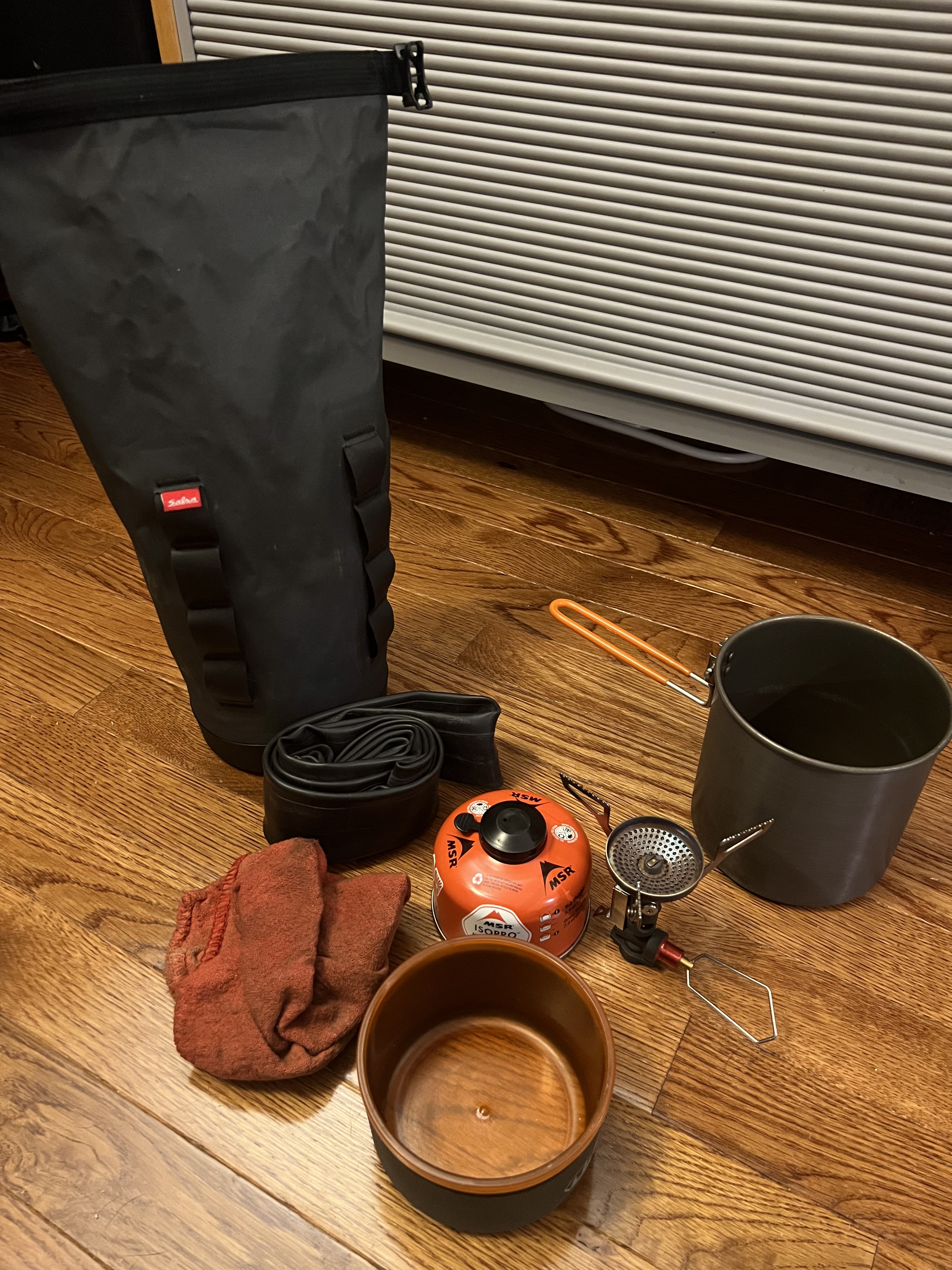
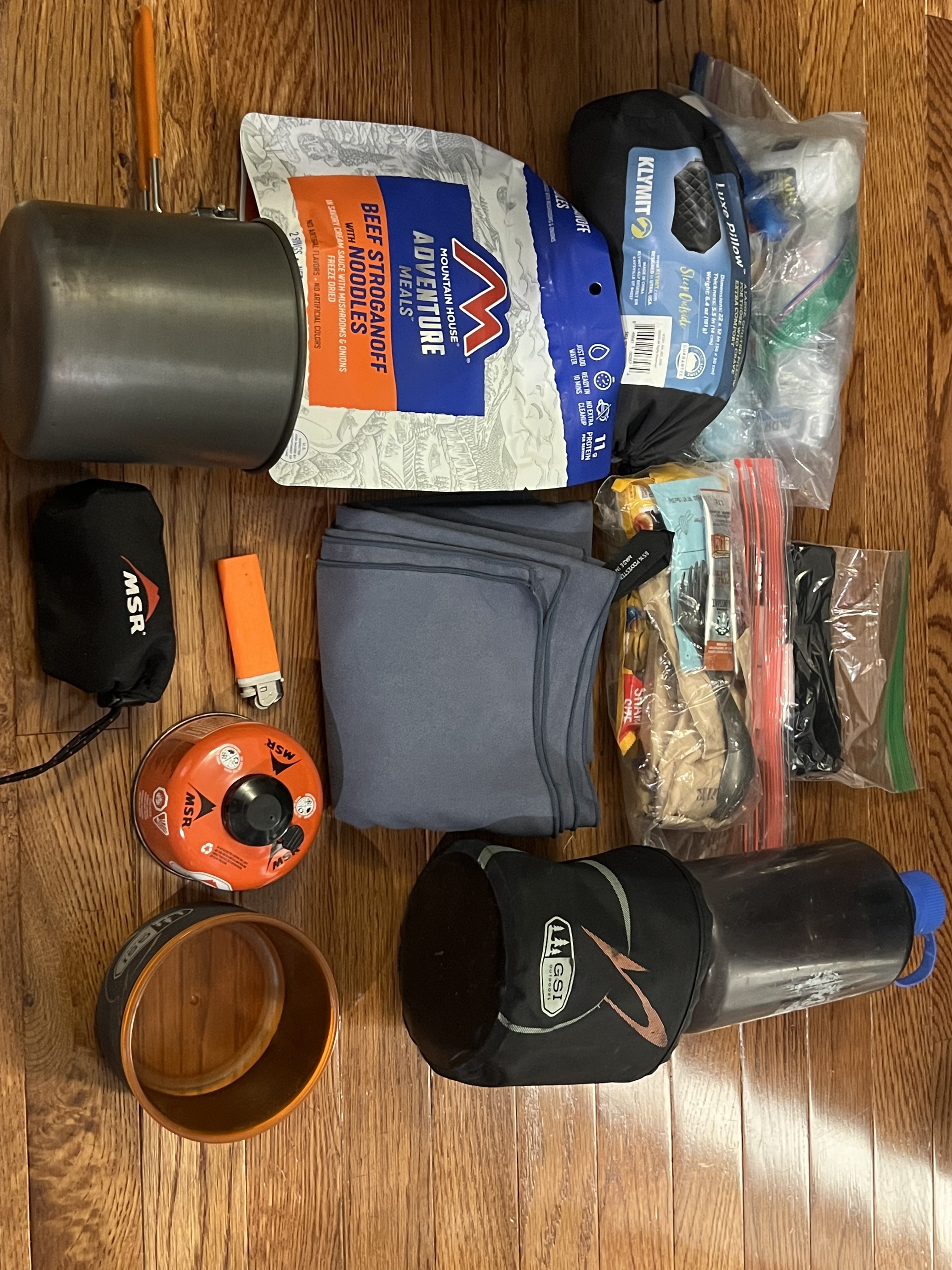
Backing up a bit, here are some shots of the gear that goes in the panniers. The only things not pictured are my shoes (Hey Dudes) and my Stanley flask filled with bourbon.

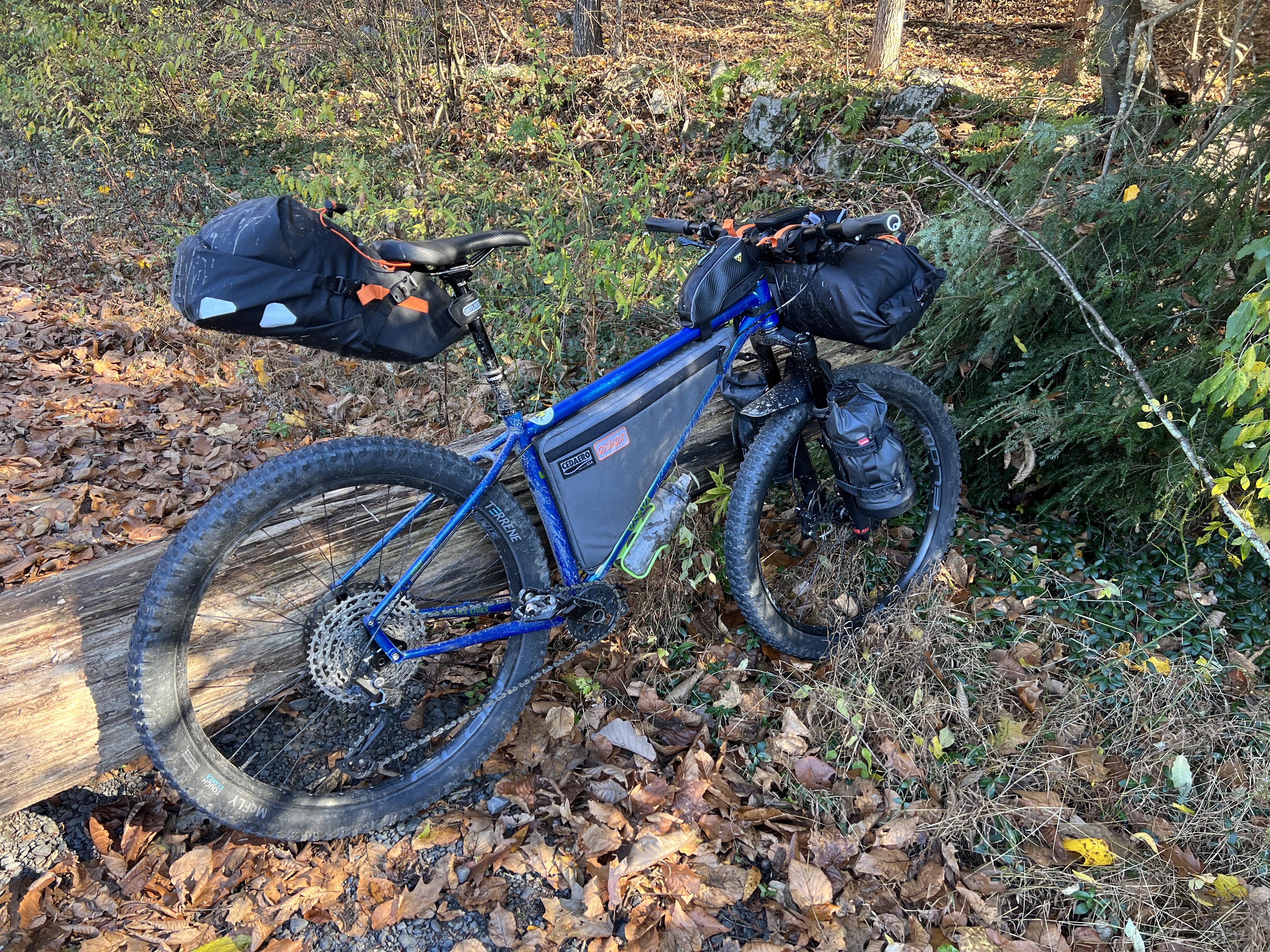
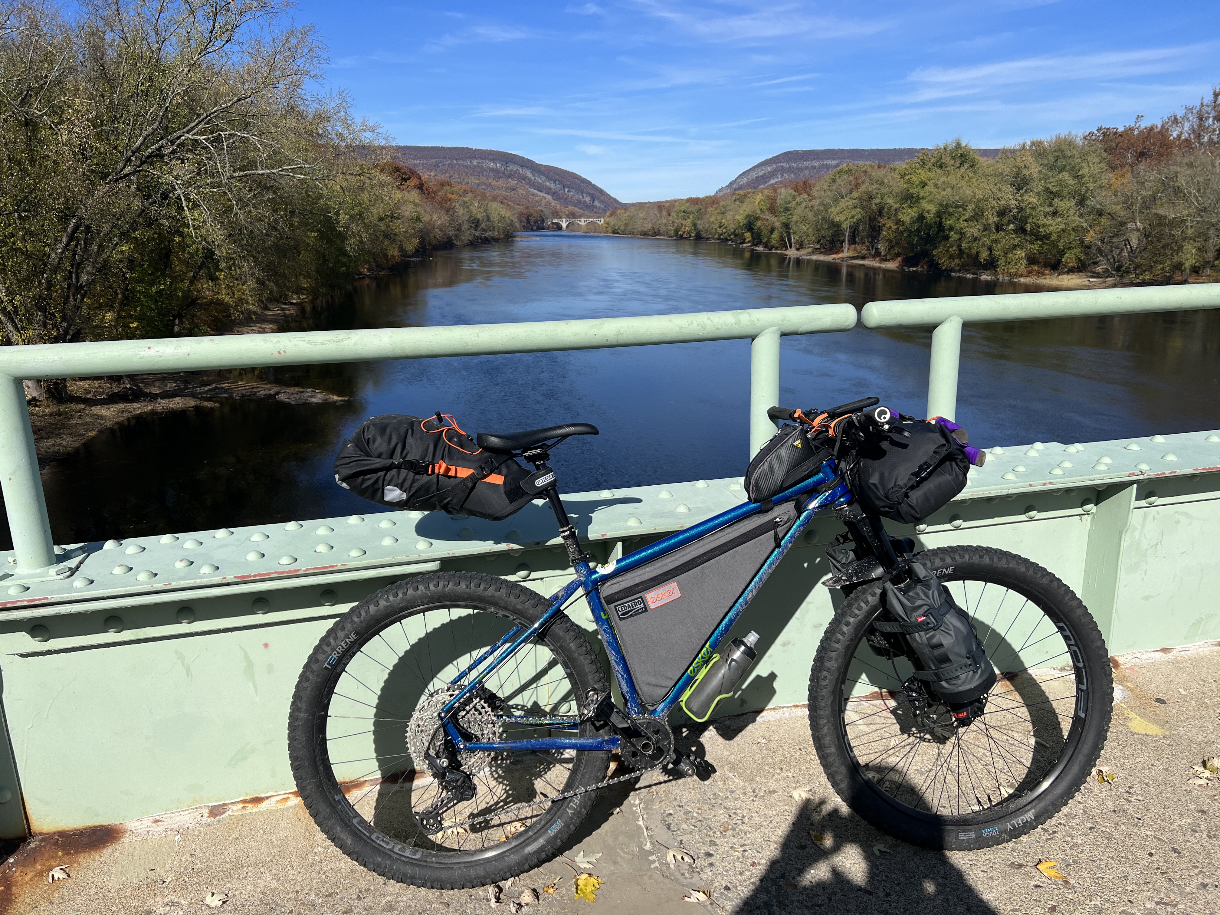
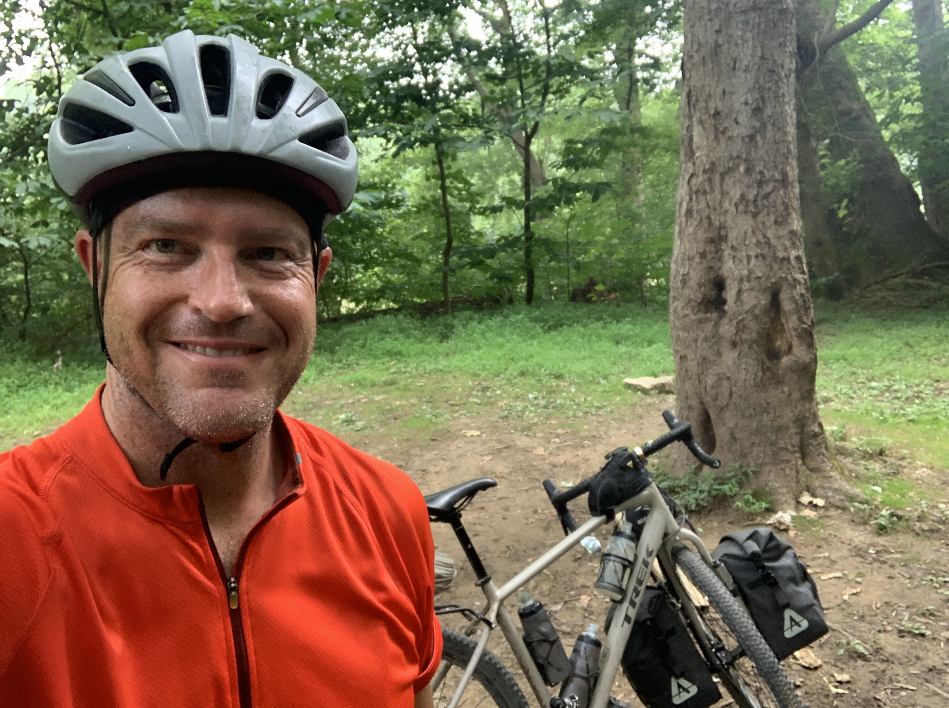
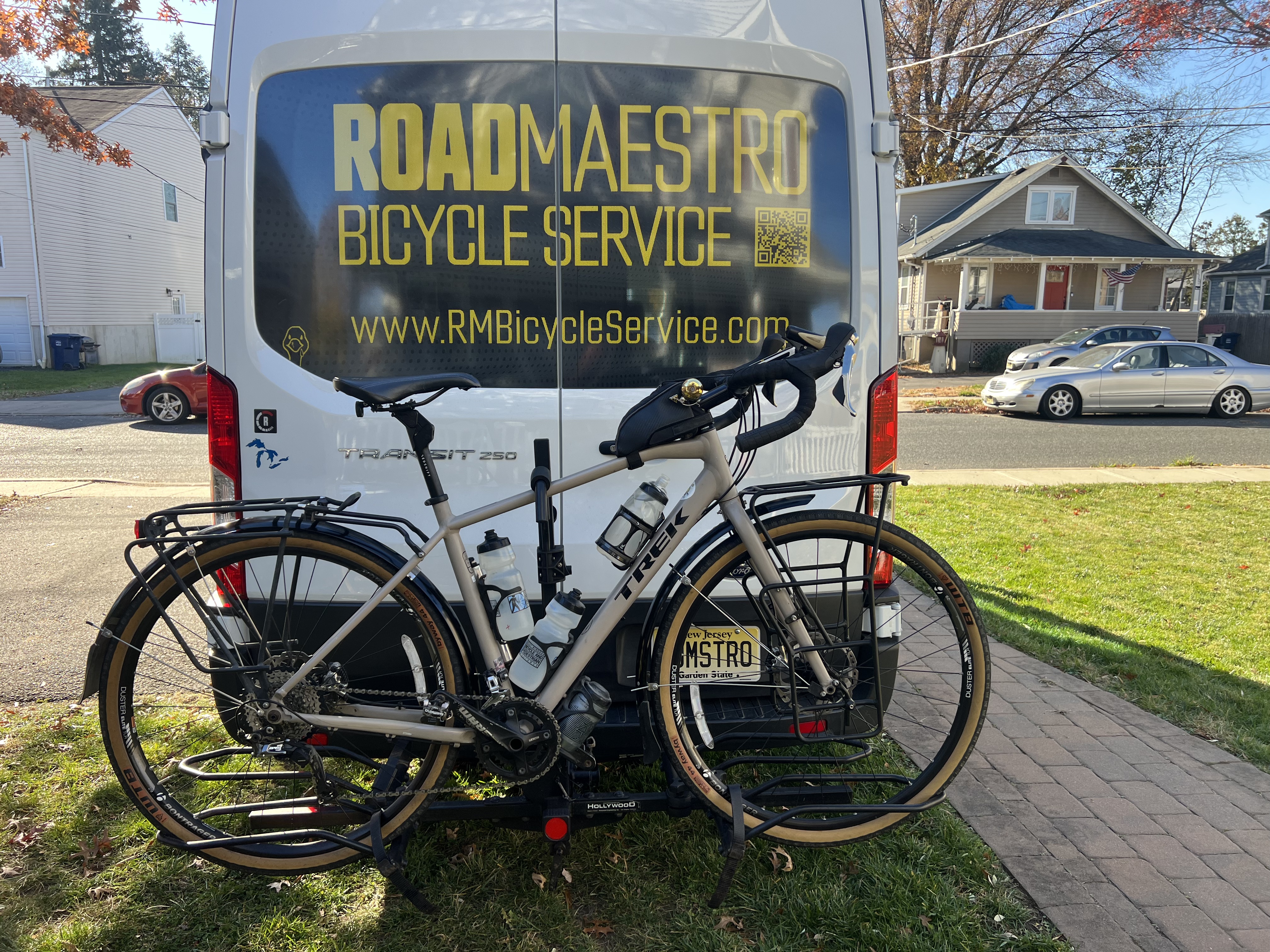
The bike is my beloved Trek 920. It’s gone through quite a few upgrades and I finally feel like it’s dialed in. WTB Byway tires, Redshift Sports Kitchen Sink handlebar and suspension seatpost, and this year I upgraded the drivetrain to full 11 speed Shimano GRX. Game changer. I love this bike!

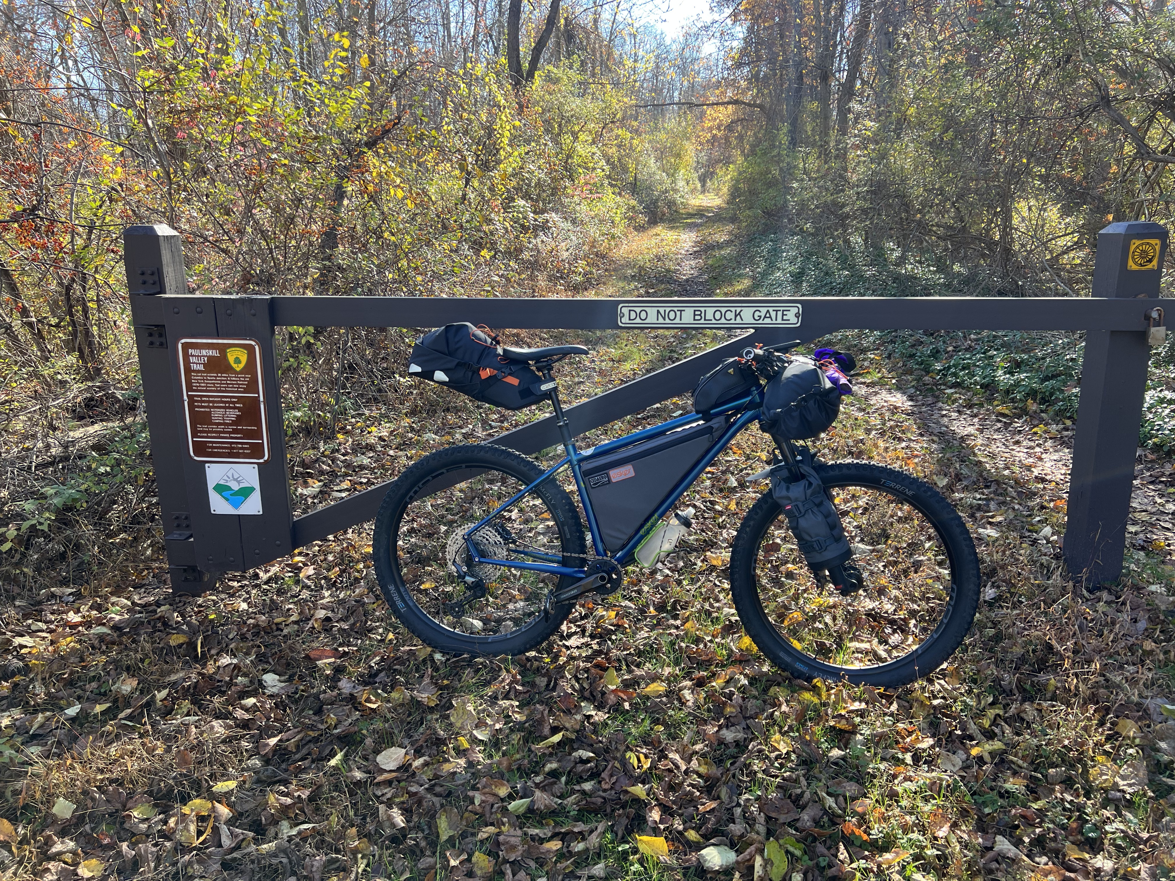
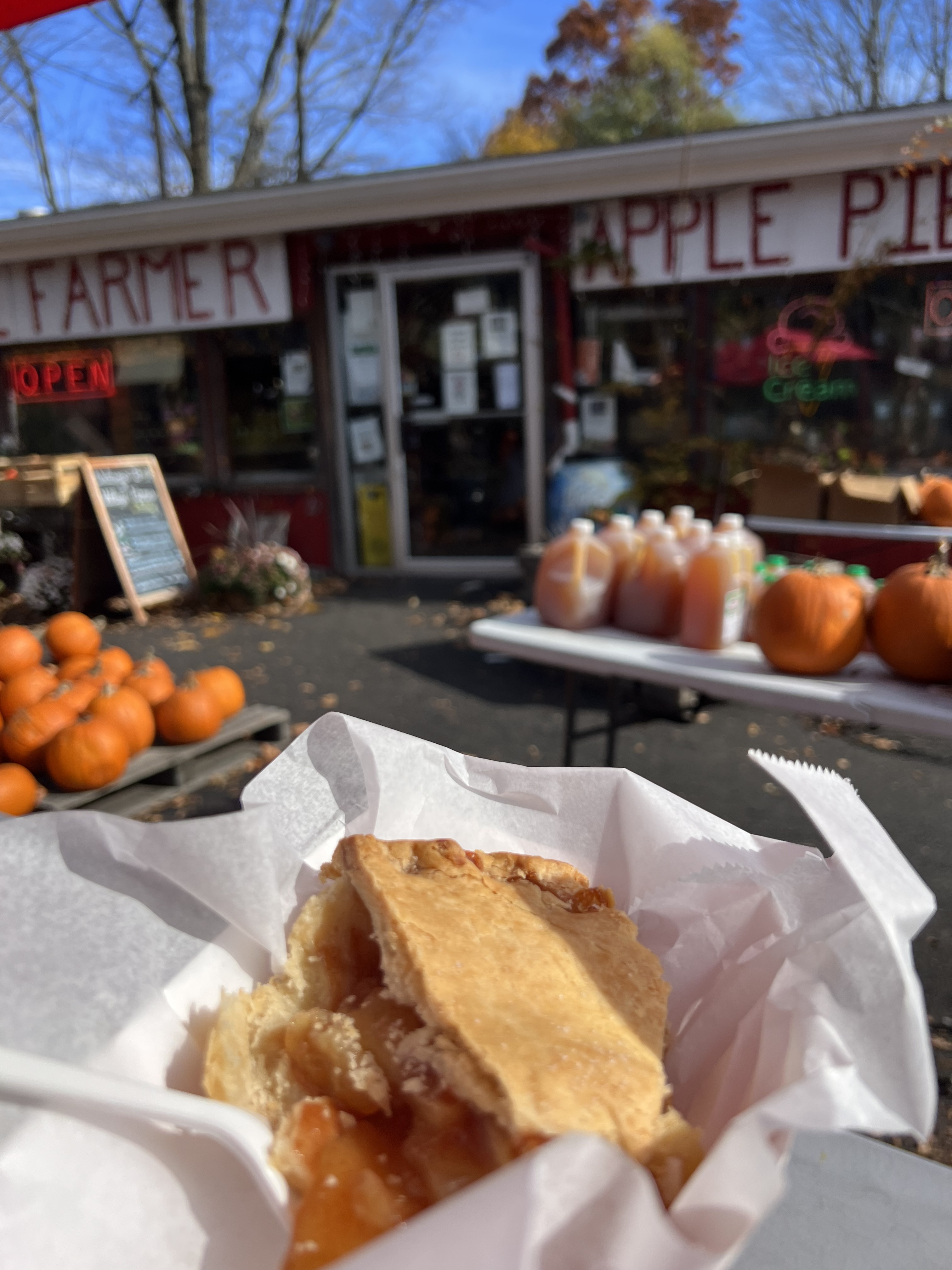
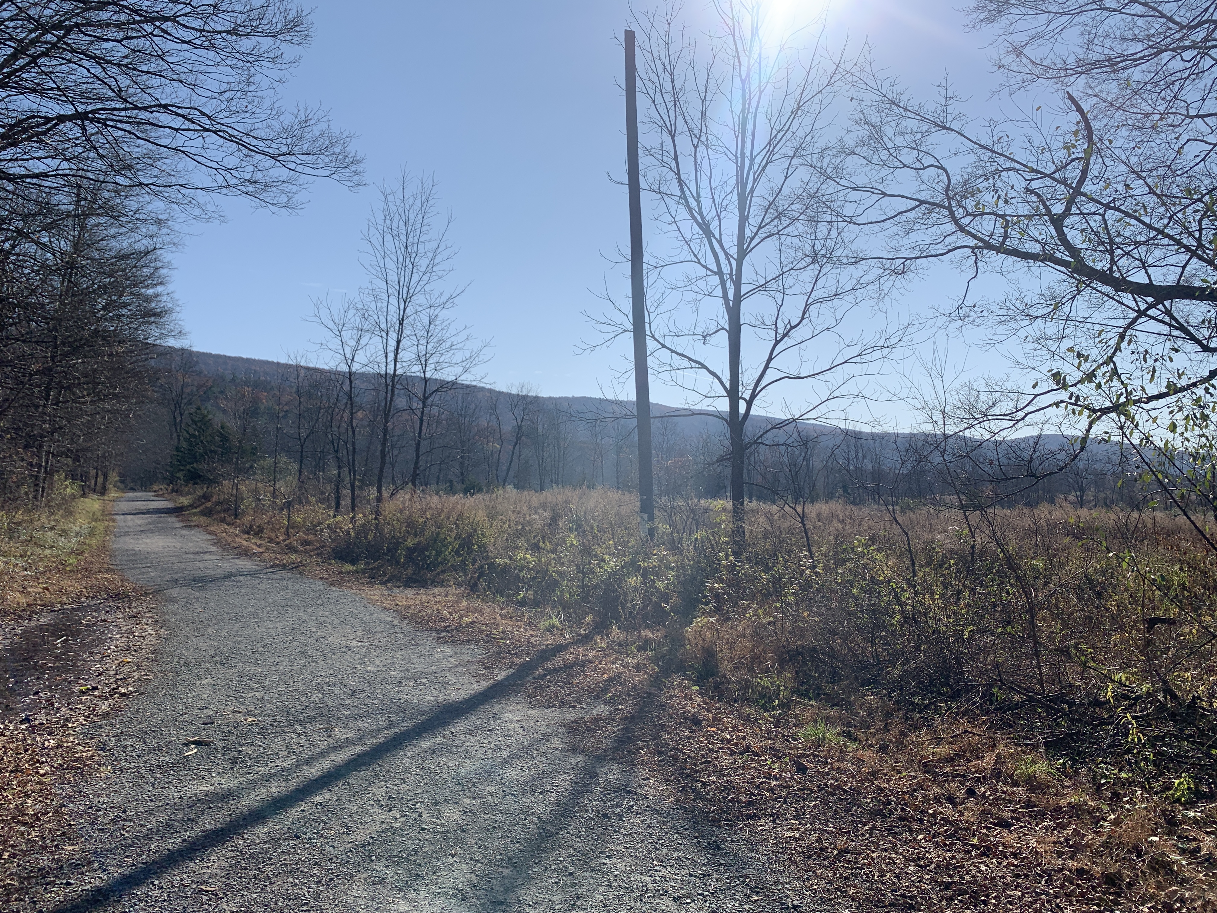
The route is easy. Flat. Smooth. Easy to navigate. All things that are perfect for the out-of-shape adventure cyclist. Kevin and I rode the smooth Schuylkill River Trail north all the way to our lunch stop in Pottstown. We found a wonderful brewery/restaurant and enjoyed a short break. After lunch, Kevin headed back home to beat the descending sun and I continued on towards camp.

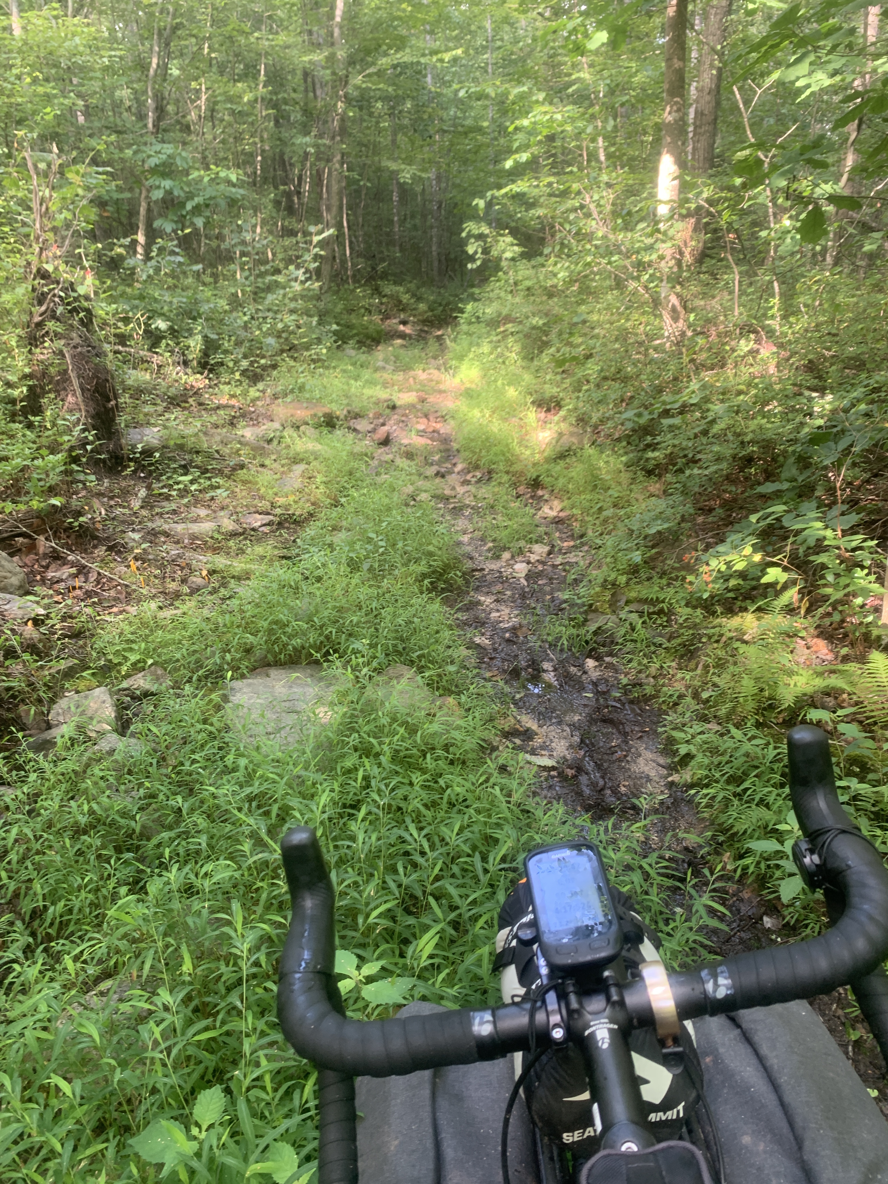
Reaching the turnoff point just shy of Birdsboro, the road heads up. The ride up to French Creek State Park is 4.5 miles, almost entirely uphill. Some sections are very very steep, especially (of course) the last little bit up to the campground itself. This final 5 miles took me nearly an hour. But, I made it.

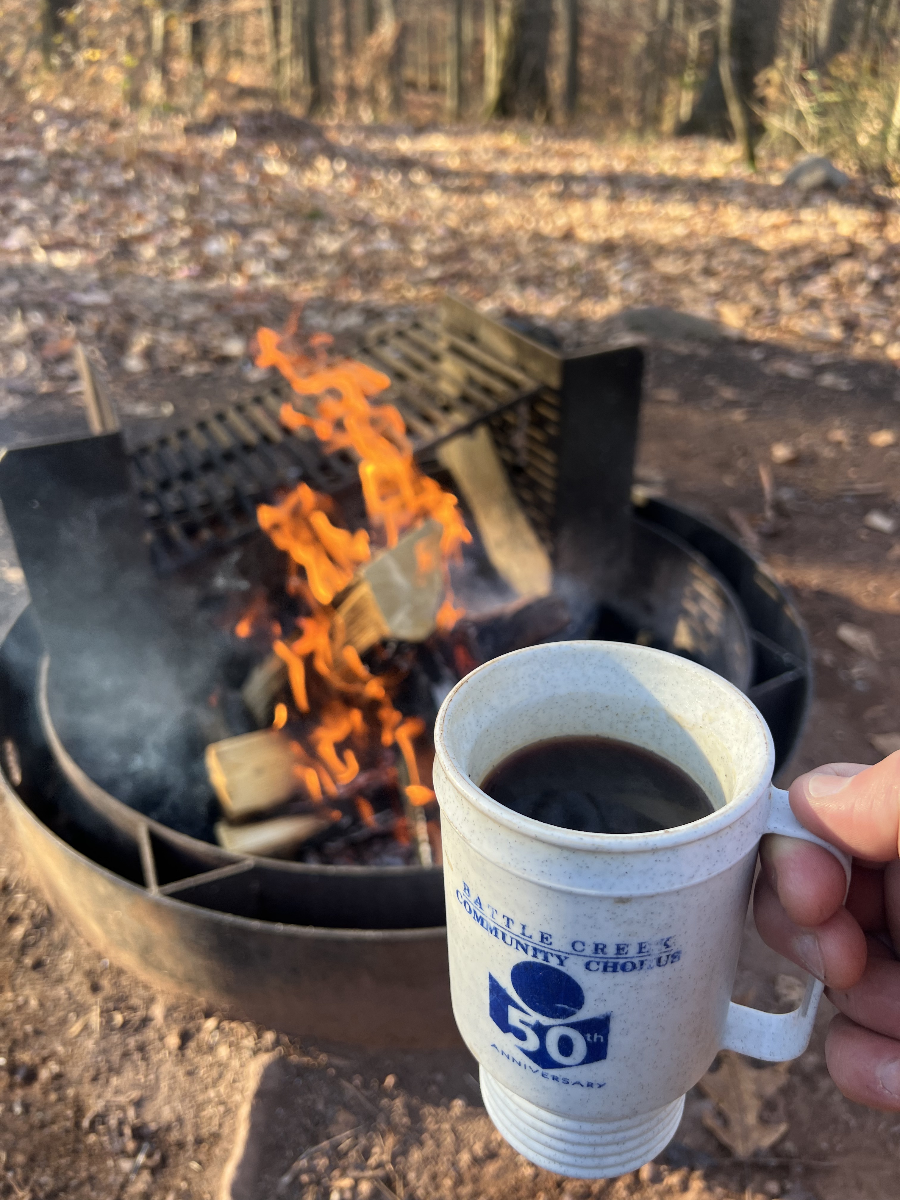
I had found a very wonderful generous kind person who was willing to deliver firewood to my campsite last year. I called him again this year, he remembered me, and was willing to do so again. So, if you’re ever in the area and need firewood, be sure to patronize Willow Brook Firewood, LLC. There’s no website, but call the proprieter, at (484) 743-4323 and he will take excellent care of you!!

The low was forecast to be 32 degrees, so I purchased plenty of fuel for the night.

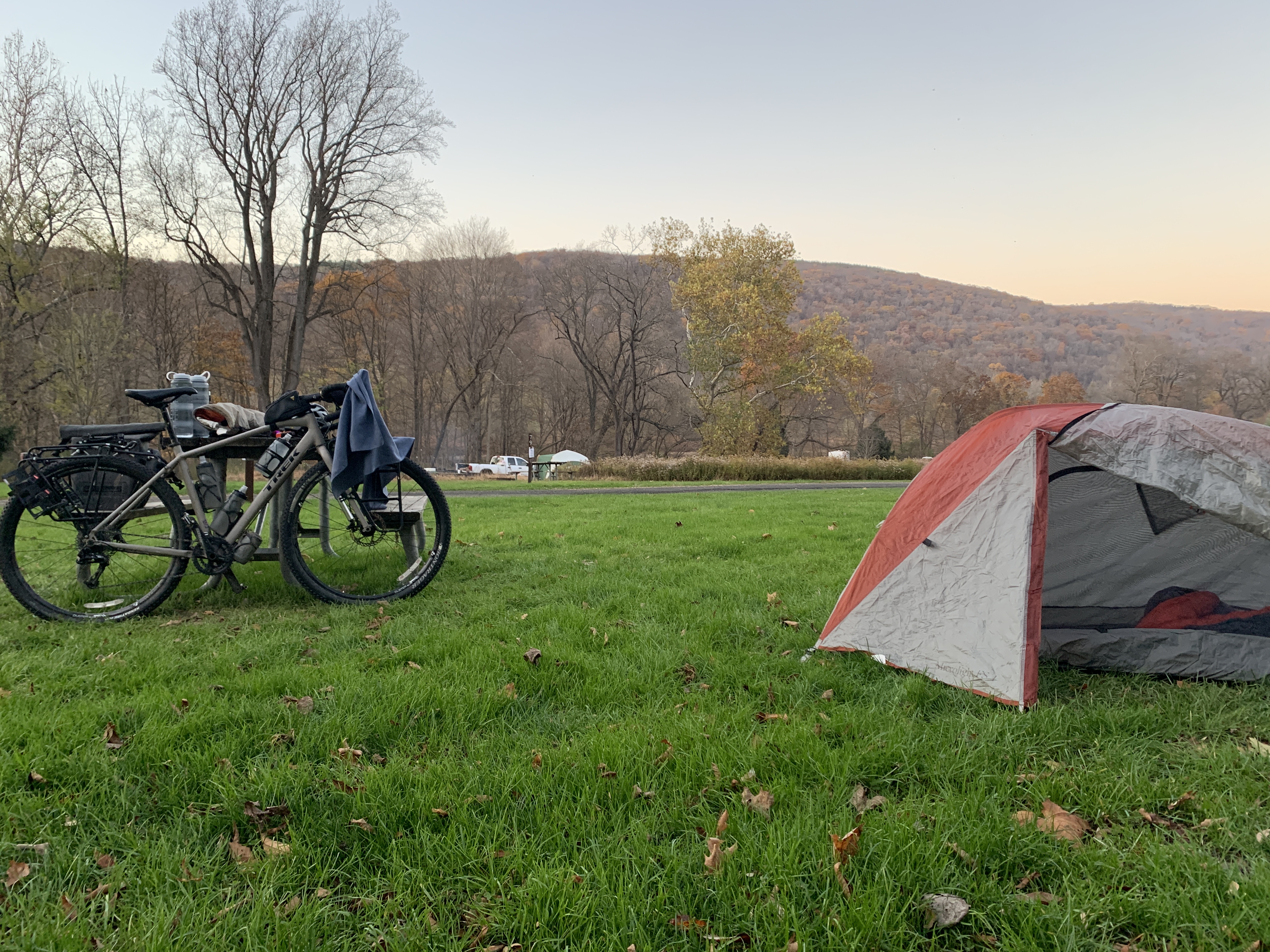
French Creek State Park is one of the few campground that is open year round in my area. There is a campground host, restrooms, showers, and water sources are open. People camp there. It’s a great resource!

It was a cold night. This amazing clear sky was beautiful to look at but also mean that it was going to be brisk. After a few stops and starts, I finally settled in and got some good rest.

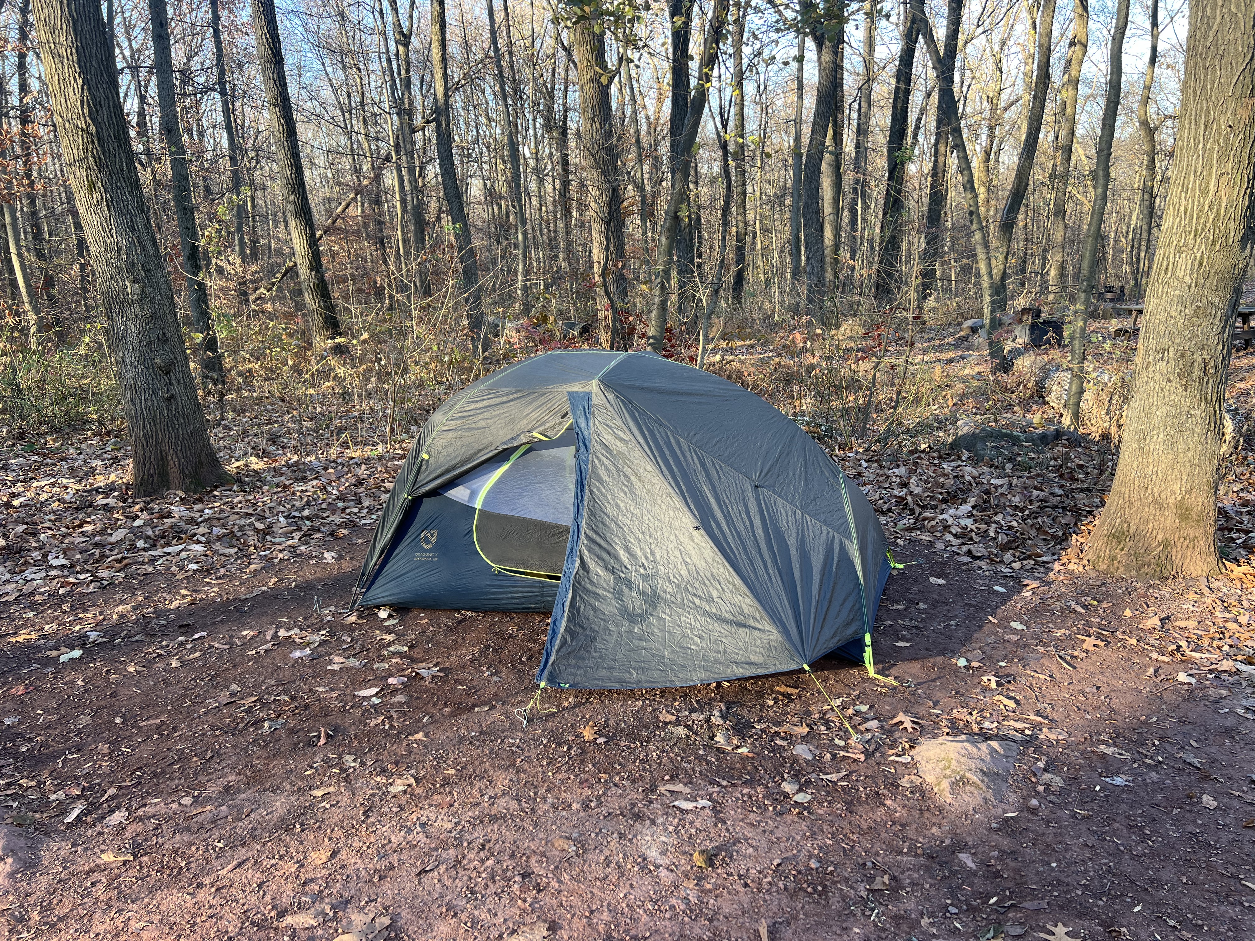
A couple gear notes here. I LOVE my Nemo Bikepacker tent! I purchased it a couple years ago and there are some really great features. A full review is here on Bikepacking.com. I also have had to come to terms with the fact that I’m not as nimble, young, flexible, or light as I used to be. I was seriously questioning how much longer I’d be able to enjoy bike camping, until I purchased a new Sea to Summit sleeping pad this spring. It’s bulky but still light, and the 4″ thickness has been a game changer.

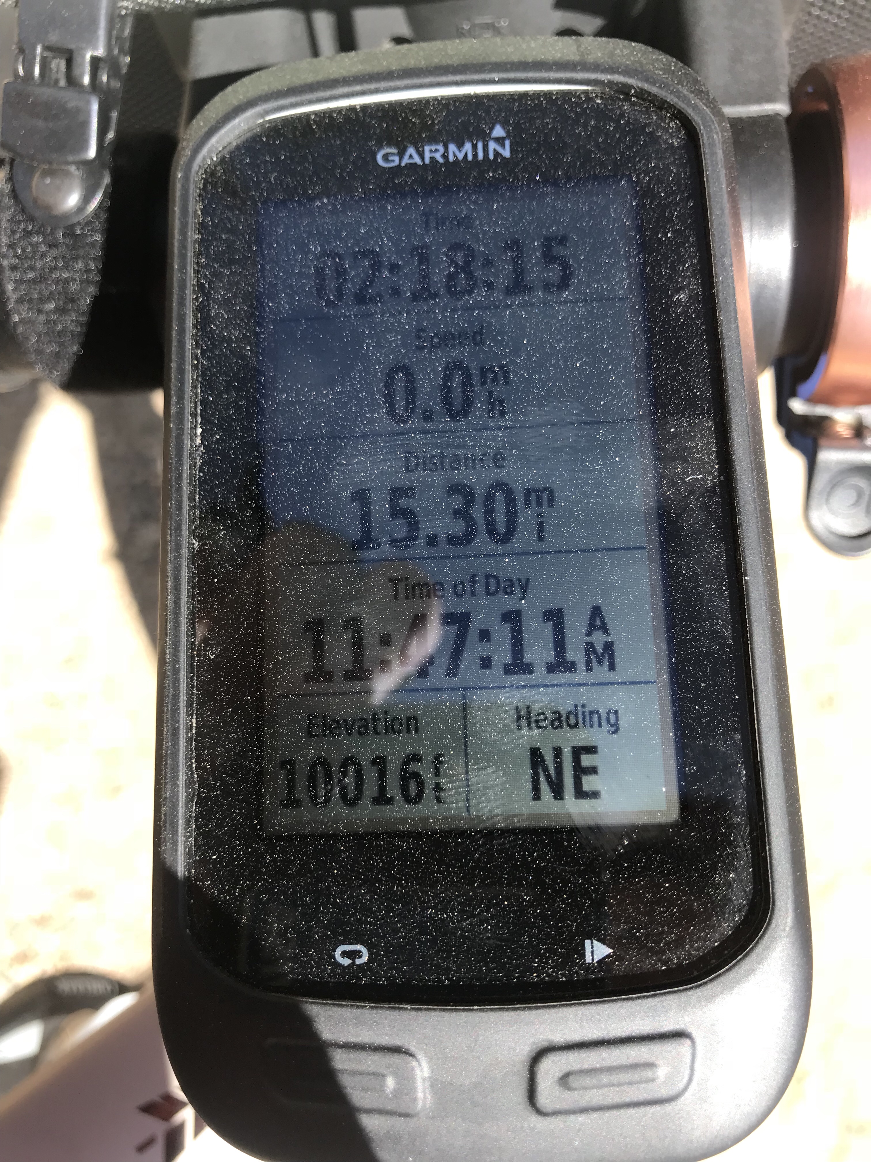
Here is the route data from day one.

After the very cold night, I climbed out of my tent into the frigid air, built a fire, and enjoyed some delicious coffee. I spent awhile letting the weather warm up a little before breaking camp and heading out.

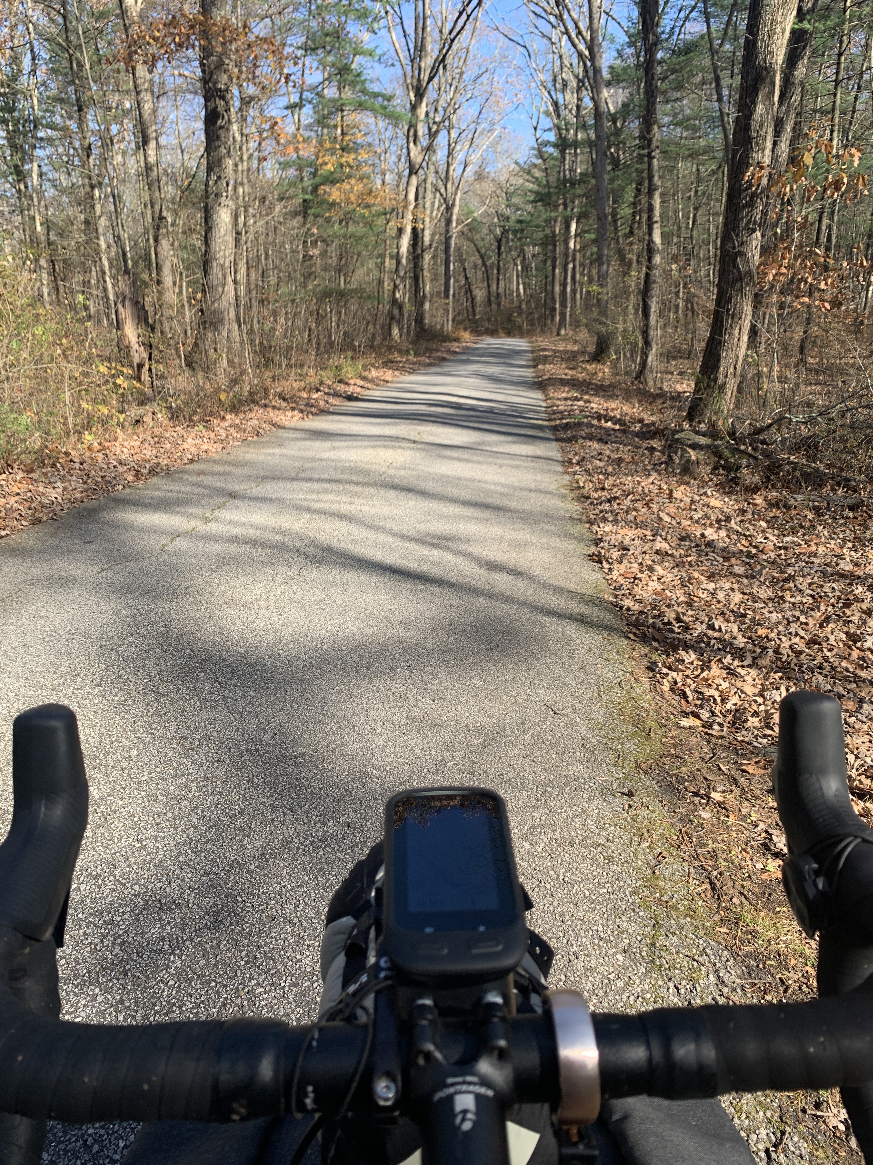
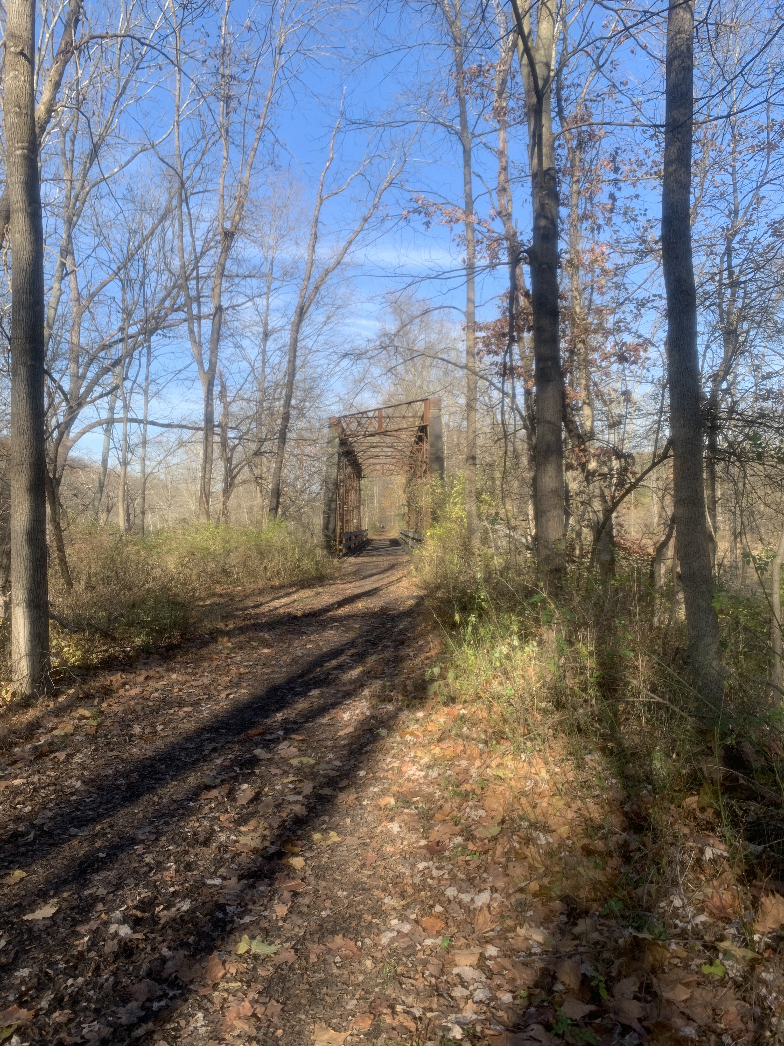
Descending at 30 mph when it’s not even 40 degrees out is CHILLY! Back onto the trail. This end of the SRT is very hard packed gravel. Almost paved. But it’s just beautiful and it’s some really smooth riding.

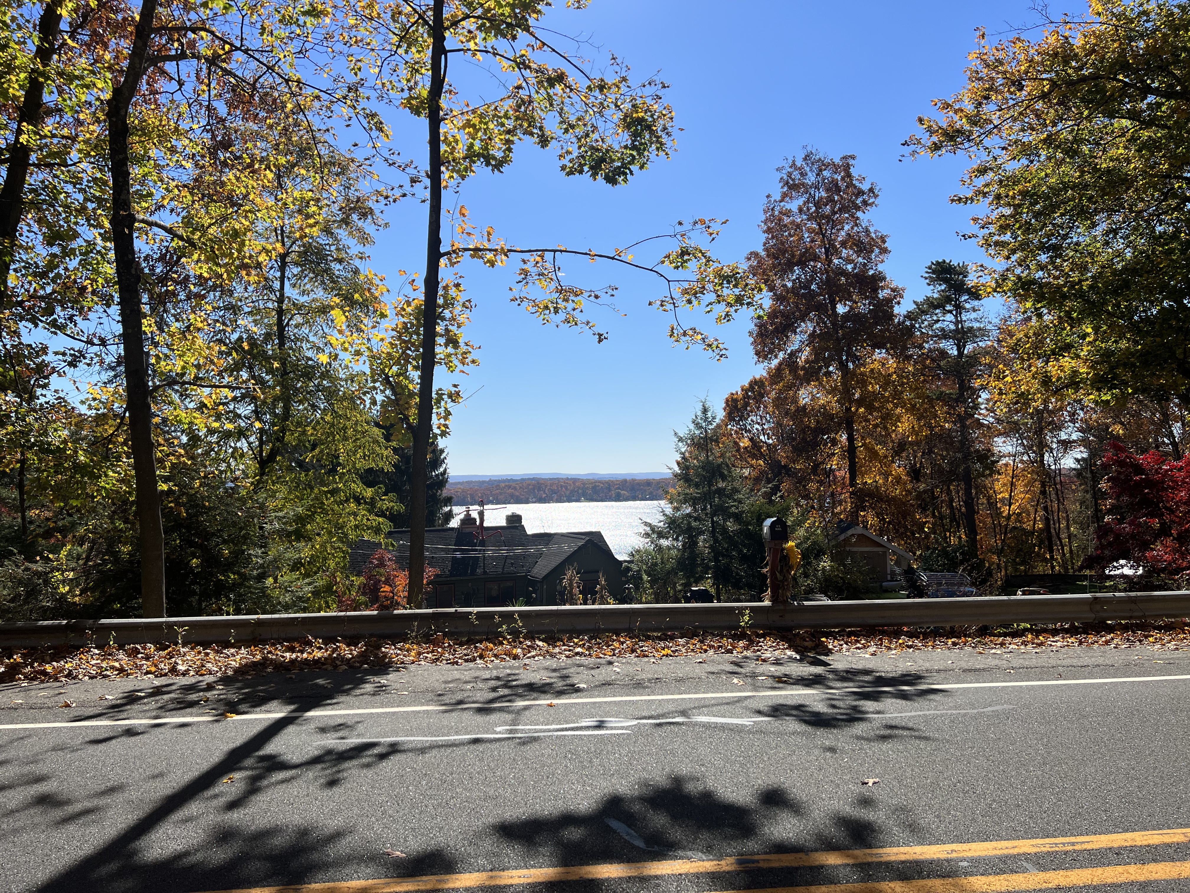
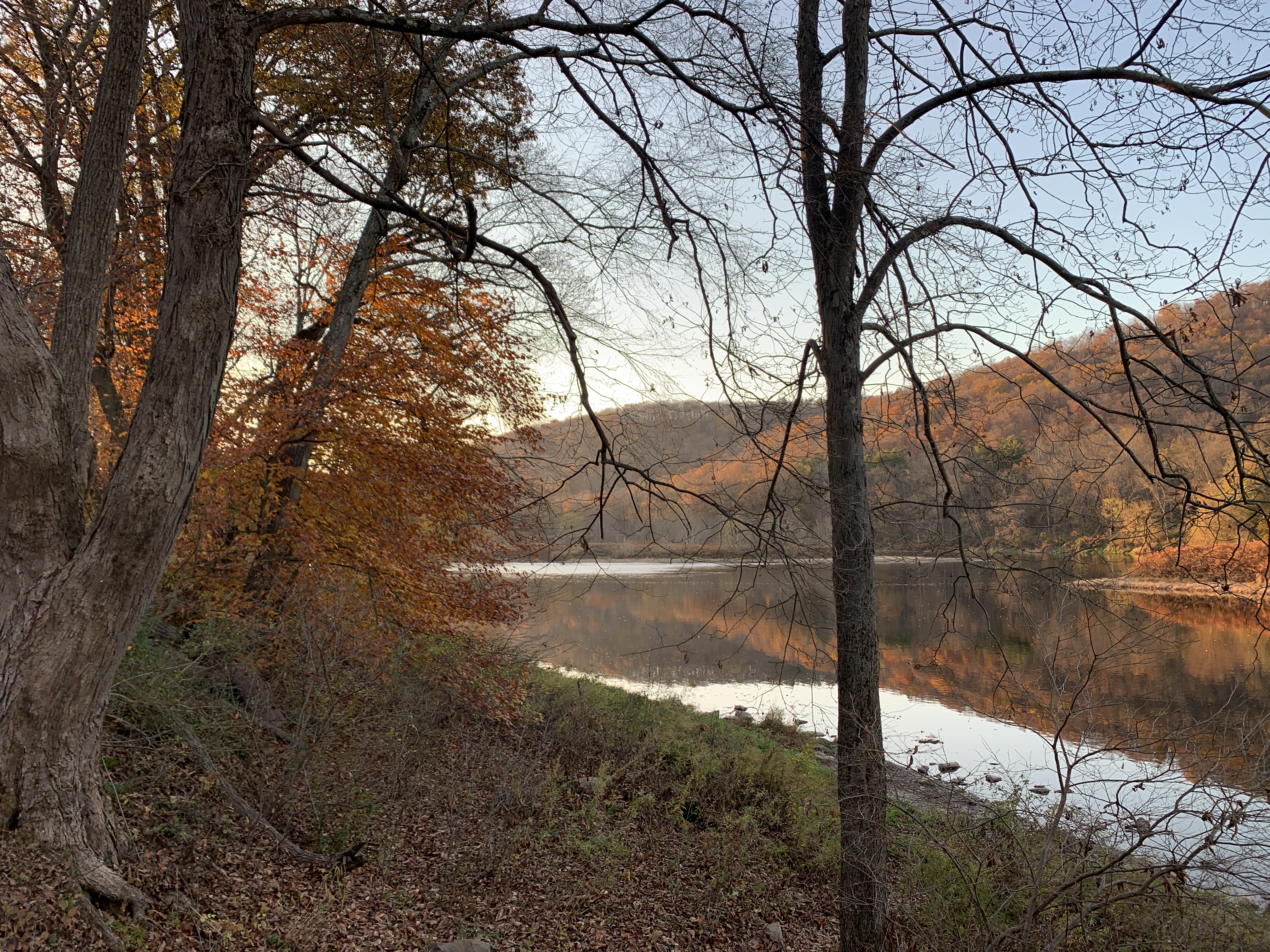
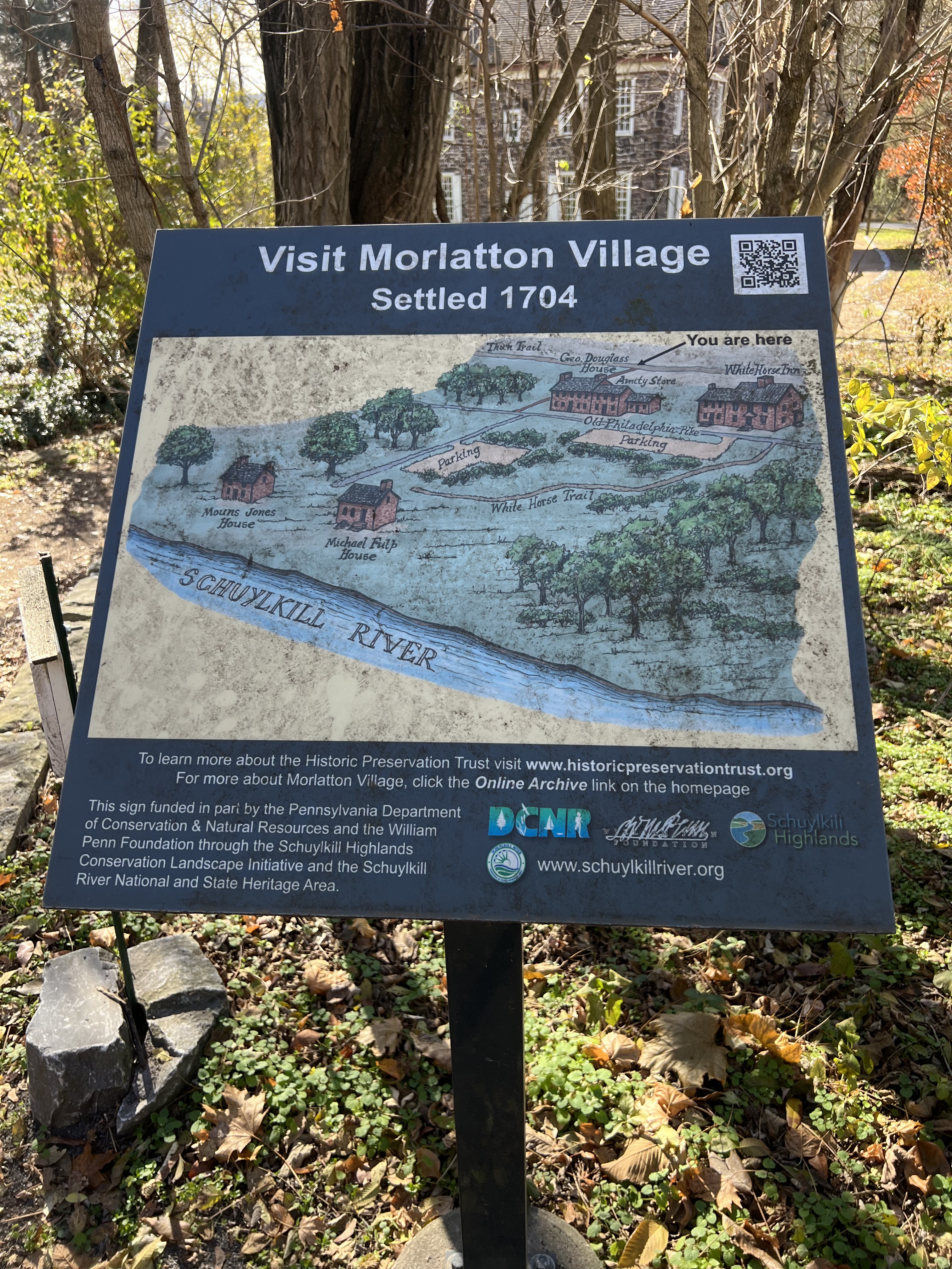
There is some wonderful history along this route. Due to the short days this time of year, I didn’t have time to stop and meander around much of it. I do intend to come back in the summer though. I really love the 18th Century history of this area and stories behind canal and rail travel.

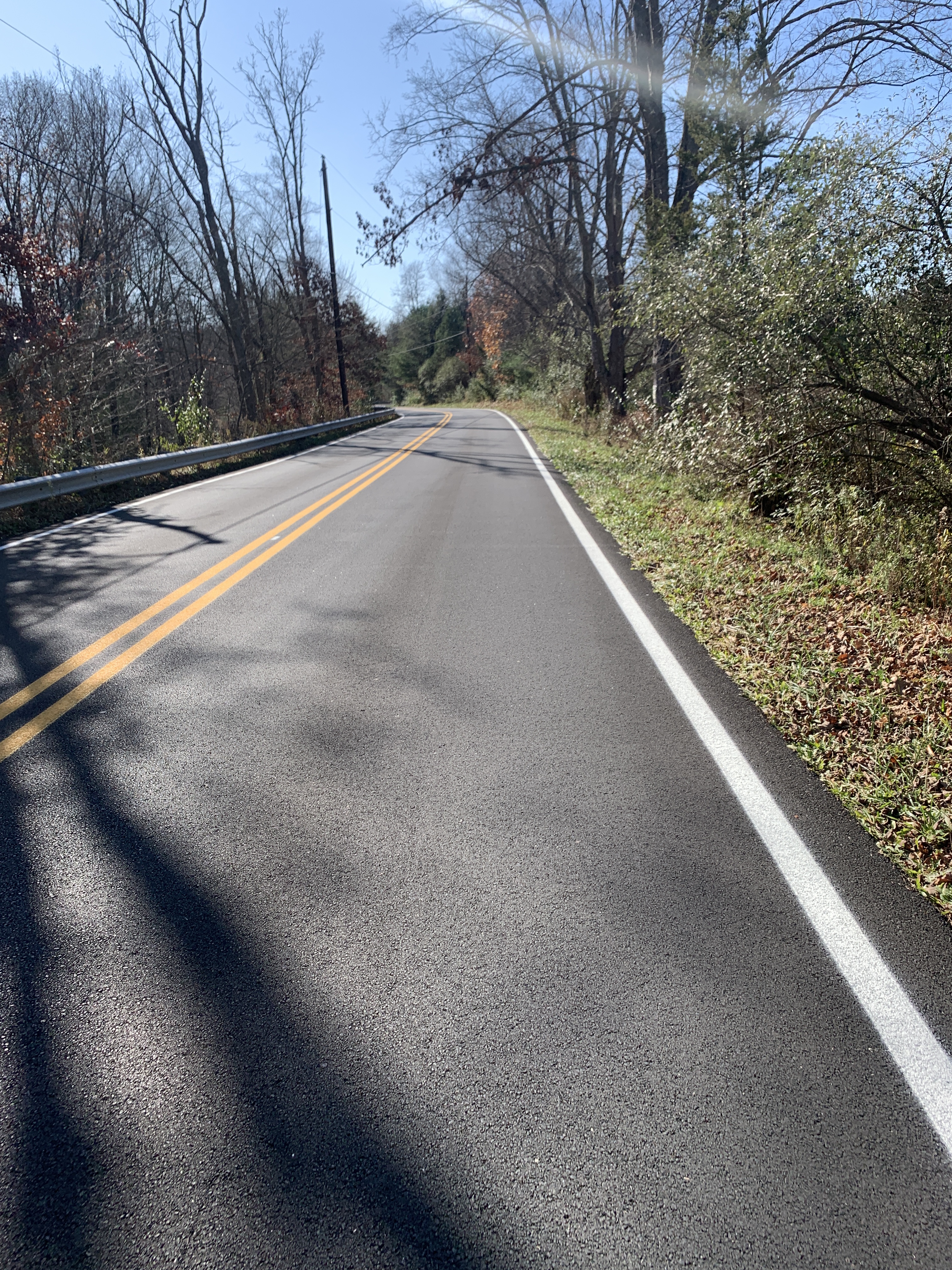
With a couple short climbs and lots of beautiful, paved trail, I made my way back to Kevin’s house and loaded my bike in the van. It was a great getaway and I’m looking forward to returning to the area.

Day 2 route data (GPS issues…ignore the elevation profile)

DWG 2022 Photo Dump

This is mostly just a photo dump of the ride I did October 29-30, 2022. The route is a slightly modified version of this route found on Bikepacking.com. I did the route a year earlier on my Trek 920 and carried my gear in front panniers on my racks. I felt I was “underbiked” for the initial section in Stokes as well as a length of trail after Buttermilk Falls. In both cases it turned the ride into hike-a-bike, which I hate. I’m pretty grumpy that way. If I wanted to go for a hike, I’d grab a backpack and go. I’m on bike. I want to ride. So, for 2022 I used my Esker Cycles Heyduke mountain bike with full bikepacking setup. It was perfect! A little sluggish on the roads but I’ll take it.

Highlights include a rest stop by a secluded lake in Stokes, Buttermilk Falls, camping at Worthington State Forest, apple pie, hotdogs, and one of my favorites….the cafe at the Blairstown airport.

Here is the route data…

Day 1

Day 2

Here are the pictures…

Permission to Coast: Delaware Water Gap Bikepacking Overnight

Sometimes a nice bike touring opportunity just falls in your lap. I’d been looking for one more night. Just one more overnight of meaningful miles, fresh air, campfire, coffee with a view, and more miles back. I stumbled upon a nearby bikepacking overnight on one of my favorite sites, Bikepacking.com. Low and behold, a nice little two day trip in the Delaware Water Gap was just 90 minutes drive away. To make it even sweeter, the timing was right for both the family and mother nature. Time to sort some gear!

On Friday, November 6, I drove to Lafayette, NJ to start the journey. Having contacted officials in Sussex County, I learned that overnight parking at the trailhead is NOT allowed. A local church graciously agreed to let me leave my car in their parking lot so I could do this trip.

I was on my trusty Trek 920. Outfitted once again with 29″x2.0″ knobby tires, front and rear racks, extra water, two panniers on front, and tent and sleep quilt on the racks. It is a great little setup for a wide variety of terrain. Since this route was listed as being at least 65% unpaved, I was confident this would be a good setup for this ride. I was right!

The Sussex Branch Trail was nice, and clearly an older rail trail. This trail was more of a flat mountain bike trail than what I’m used to as a recently-surfaced rail trail. Leaving the path, I headed onto a few miles of pavement and a couple STEEP climbs (20%+) as I made my way into Stokes State Forest.

After riding for a short time on Sunrise Mountain Road, the route took me onto hiking trails. Not biking trails. Not multi-use trails. Hiking trails. It was beautiful, and I’ve backpacked on these trails before, but these are most definitely not designed for bicycles.

Stunning views, but this was hike-a-bike terrain. Fortunately it only lasted for a couple miles, and I was back onto some uber-smooth pavement. That took me to a nice two-track that was exactly what I was looking for. Rough but rideable, challenging uphills and big puddles and stream crossings, beautiful views.

Eventually the road/path led to Buttermilk Falls. Since the weather was SO perfect (70’s during the day in NOVEMBER??) there were plenty of people enjoying the falls. I took a few photos and kept moving. A challenge of a November bikepacking trip is lack of daylite. It was already almost noon and the sun is down around 5 pm.

After the falls there was a left turn onto something. I’m not sure what. But I’ll say this: there were three guys on off road motorcycles inching their way DOWN the trail because it was so technical, while I was pedaling my very-unmotorized bicycle UP the trail at about the same speed. “Oh man you are a BEAST! God bless ya man!” they cheered. I did my best to smile, while cursing the terrain under my breath. This was straight up, and another mile or three of alternating between hike-a-bike and grueling 3.5 mph “riding”.

Eventually I reached the top, and enjoyed a relatively easy descent to Millbrook Village. It’s a lovely “living history” place tucked away in the valley.

Another crazy steep climb up Old Mine Road to the Hamilton trail, which is essentially just an abandoned road, and I was within a couple miles of my destination, Worthington State Forest Campground.

The views were stunning, dinner was delish (Backpacker’s Pantry chicken teriyaki), and the campfire was cozy. Oh, and the hot shower felt amazing!

After a very chilly night in the 40s, I enjoyed oatmeal, coffee, and campfire and lingered long at the campground. Truly, I was just waiting for the sun to warm things up a bit.

I have ridden this next leg before, on my 2013 trip up the Delaware. It’s pretty fun to join the Appalachian Trail as it crosses the Delaware River on I-80.

Madeline and I have visited Village Bakery before, when we hiked Mt. Tammany Summit two years ago. The hot dogs are still good, and the pie is excellent!

The next stretch was a bit of pavement spaghetti, winding down and around to avoid the freeway. Down next to the cliffs, near the water, next to the exit ramp, and finally crossing in Porter on a pedestrian bridge and meandering over to the Paulinskill Trail.

There was lots of equestrian traffic on the bike path, and my GPS started sending me mixed messages about where to go. Additionally, the path was back to “not my usual lovely rail trail” surface. Deep ruts, long mud patches, downed trees, even missing bridges. But, eventually, 20 miles into the day, I made it to my lunch stop.

I’m a fan of aviation, and I especially love gliders. So to be able to eat at a trailside cafe that is AT a little airport is completely ideal. I was able to wait for my meal and enjoy my sandwich, all while sitting at a picnic table in the sunshine watching airplanes take off and land!

Despite more deteriorating trail conditions, and my Garmin playing Choose Your Own Adventure with my directions, I eventually made it all the way back to my vehicle. There were still some stunning views, and overall it was a delightful trip. Just what the doctor ordered!

All the gear held out well, though I wish I had brought thicker socks. If I do this again I’ll certainly cut out the hike-a-bike sections. It’s just not my thing. But the unpaved biking, rough roads, jeep trails, and twisty mountain roads were wonderful. It’s like flying, but more fun.

Day 1 route and stats

Day 2 route and stats

Permission to Coast: Trans Virginia Route (Day 5)

Finally a good nights sleep after two rough ones. Started out pretty hot but eventually cooled off. I’m sure part of the good sleep was the stress of the hard miles being behind me.

IMG_6535

Woke up a little before 7 and checked the weather. Already humid. Highs near 100. Decided to move quicker to beat the heat so I was moving by 8:30. Legs hurt a lot but I pushed a pace of 14-15 on the trail for the first 25 miles. At that point the heat really started to take a toll. Took a break at Great Falls Tavern. Refilled bottles as I had already gone through the three on my bike. The break really helped. Decided to ease the pace since it was getting so hot. Towpath was very muddy and rocky for the last few miles.

Made Mile Zero about noon. Great to finally see it! I have ridden the Towpath several times, but never actually found the trailhead in Georgetown.

I hopped on the Rock Creek Trail for the ride downtown. As I rounded the corner underneath the KC and saw the Lincoln Memorial Got veeeerry emotional. This trip has been more than a year and a half in planning, and a lot of preparation of logistics and fitness this summer. As I enjoyed a break at the Lincoln Memorial, I chatted with a lovely couple from North Carolina, and even pointed out some of the sites for them to see while in town.

IMG_6550

From the National Mall I headed to Crystal City via paved bike path. It was a smooth easy ride, though hot still.

Everything hurts. Everything smells. Shower was glorious. So was air conditioning.

Day 5 stats on RideWithGPS

46 miles

13 mph average

3:40 riding time

Permission to Coast: Trans Virginia Route (Day 4)

Woke up late at 9 due to the late night noise from my neighbors. I decided to take my time this morning at camp. I had a morning fire, and enjoyed some views of the valley below from the Bear’s Den Rocks along the Appalachian Trail.

I had been looking forward to an easier day on the bike, but…

I started straight downhill for the first 5 miles. Scary descents – steep and curvy. The next five were rolling on smooth pavement with a few really loose gravel roads. I rolled into Purcellville and decided to have lunch there. It’s a lovely little town, and I was able to score some socially-distanced dining at a cafe.

IMG_6501

I reviewed the route one more time. I knew there was another monster climb up Charles Town Pike. Traffic, steep, very little shoulder. Getting there was tough. There were some very very looooose scary gravel roads. Finally made the climb (25 minutes, 2.5 miles), then up and down constantly on Chestnut Hill Road. Really hot today and humid. Made the climbing that much harder.

The big goal today was to get to Harper’s Ferry, enjoy a rest stop there, make my way across the river, and settle in to some easy (flat) miles on the C&O Towpath.

Finally made HF and had an ice cream cone. Met a guy who was on day 33 of a ride from Santa Fe to DC. Later, about 7:45, he whizzed by my campsite.

Riding the Towpath is nice, flat, but very dirty. I was able to ride a steady 14 mph on the towpath. Had a good rhythm so I rode to the Marble Quarry hiker biker site – an extra 9 miles.

Alone at the campsite. Previous tenants had left some firewood for me!

It was a gorgeous night on the Potomac, accompanied only by the sounds of birds, bugs, and bullfrogs!


Day 4 stats on RideWithGPS

52 miles

1800’

12 mph average

HOT

Permission to Coast: Trans Virginia Route (Day 3)

This was another nice camp site in another beautiful setting. Rough night for sleep though. Hips in complete agony from all the climbing. Woke up every hour or so with cramps or numbness.

Rolled out starting downhill for a couple miles then hit some hard but short climbs. After the first 5 miles or so it was rolling terrain. The stretch south of Wheatfield was amaaaaaazing! Smooth gravel and lots of easy descending. A very welcome reprieve.

At mile 30 started to really feel the heat and miles. Stopped for a break, snack, and tried to find some shade. Pushed on to mile 42, Shenandoah Mart. It was not nearly as nice as I had hoped, but I restocked water, had a coke, some chips, etc and took a long break in the shade.

I hit Harry Byrd Hwy at mile 55. Started with zero shoulder and rumble strips, but rode downhill to the river. Eventually a gravel shoulder emerged which I rode on for the long hard 7%+ grade. Hot. No shade. Stopped twice for breaks. Traffic flying by at 70. Turned right at the top and it got steeper on 601 for the 1/2 mile to Bear’s Den but I rode the whole stretch.

I took a long time to set up camp and recover. I had been looking forward to a cold beer and hot meal at Bear’s Chase Brewing at the end of this hard day and I was not disappointed. What a beautiful facility! It was good to walk the 3/4 mile or so from my campsite to the brewery to help stretch the legs.

I returned to camp and enjoyed my first campfire. Neighbors got in at 10:30 and kept me up till 3. It was not a great night for sleeping, and I was really starting to feel the miles and the heat.

Good riding day. Glad the hardest part is over.

Day 3 stats on RideWithGPS

60 miles

5:30 riding time

4000’

11 mph average

Permission to Coast: Trans Virginia Route (Day 2)

On the first night there was some kind of hunt going on further up the mountain. HOWLS of hound dogs went on for a few hours, but eventually settled down. A couple pickup trucks rattled down German River Road by my campsite.

The dogs quieted down by 10 pm. A few bumps in the night but overall it was very good. I got a little chilly and used both my lightweight CoolMax sleep sack then added the quilt.

This was a crazy hard day. The first 5 miles were exceptionally difficult. Rocky, downhill, muddy, stream crossings. After 5 miles the road became a beautiful country road and pavement began.

Stopped at Bergton Grocery around 10 am for some hot breakfast and picked up a few snacks, refilled water, etc. Nice little place where everyone is on a first-name basis. It seems they’re accustomed to lycra-clad cyclists stopping in.

IMG_6439

Next 20 miles were beautiful and pretty easy. Paved, rolling, country roads. Overcast skies. Cool weather.

Serious climbing began at about mile 25. Still paved, but long climbs and steeper than yesterday. Average 7% or so with kicks about 10. The long climb that began at mile 31 took an hour and 15 minutes. Long and steep, up to 3500’ again. Pavement ended about 2/3 up that climb. Descent was terrifying. Steep and sometimes loose stones, rode the brakes to keep it under 30 mph.

IMG_6444

After that descent was more climbing,

IMG_6447

From mile 40 to about 51. Again, steep. Forest road 92 was beautiful though! Good road for the first portion and climbs weren’t quite as steep early on.

Hiking began at about mile 51. Brutal. Like hiking the AT while pushing a loaded bike. Finally got through that after about an hour and a half. I had been warned about the “hike a bike” section, and it was for real. This was a very rocky, overgrown hiking trail and seemed to go on forever at the end of a hard day.

IMG_6449

After completing this section it was a smooth descent to the campsite.

This was a really hard day. Body is fatigued. Cycling legs actually feel good still but hips are sore from all the hiking. Back too.

Day 2 stats on RideWithGPS

55 miles. Lost data while hiking

4530’ of climbing

9 mph average

6 hours riding time

Permission to Coast: Trans Virginia Route (Day 1)

I had hoped to make this trek last summer but it was a low mileage spring. I realized in mid-May of 2019 that I wouldn’t have the fitness to handle any kind of misfortune (reroute, detour, closed campground, etc.) so I bagged it. Now, having done the tour, I fully understand that it was the right decision.

My route is essentially the northern half of the Trans Virginia Bikepacking Route. I have family in Harrisonburg, VA, so that makes for a good launch. After spotting my car in Washington D.C., I left at about 10: 15 am on August 7.

IMG_6403


The first 10 miles were paved, smooth, rolling roads heading west on Mount Clinton Pike. I have ridden the climb up Hopkins Gap before, and the elevation profile showed it as a minor bump compared to the long climb up Long Run Road. The HG climb is a leg breaker though – nearly a mile at a 10% plus gradient. Steep and hard, but it felt good to get it out of the way. Having made the left onto Long Run Road, the pavement ended, the sign at the church read “The struggle is real, and so is God”, and it was time to really ascend. But it wasn’t steep! It was much easier than anticipated and the gravel was mostly smooth. Until the top.

IMG_6415

The top of Long Run gets really loose, rocky, and steep, then the other roads I was on were steep downhills, slippery (pouring rain now), not much surface for biking, and lots of rocks. I had to hike my bike down the hills for safety. Eventually I made my campsite along the German River. It was truly remote, and very very beautiful.

During the bumpy first day’s ride my fancy bottle holders shook loose, so I spent about an hour in camp working on repositioning them so they’d be more stable. I received a lot of questions about this setup, so here are a couple photos. The inspiration came from this post.

It was a good first day! I was definitely spent, but overall feeling strong still. The last few miles were legit mountain biking, which is really hard to do on a loaded touring bike. Hoping for not too much more of that.

Day one ride stats on RideWithGPS

29 Miles

4400′ of climbing

7.7 mph average

3:33 riding time


Gear Notes

A few pieces of gear deserve mention from this tour. Most of what I used worked great and, of course, a few things didn’t perform as well as hoped.

A few years ago I purchased a nice little tent from LL Bean. I had seen this review from Backpacker Magazine for the 2 person version, caught a good sale, and assumed the 1 person model would be just as good.

https://www.backpacker.com/videos-photos/editors-choice-2012-l-l-bean-microlight-fs-2-tent

I’ve used the tent for a few trips now and, in general, it has been a trusty shelter for summer nice-weather camping. However, what I discovered on night two of this trip was that there are not enough guy points on the rain fly. It was quite breezy and cold that night, and there was no way to secure the fly closer to the ground and keep it taught such that the wind wouldn’t come up and under into the main shelter. I’ve camped in the rain with this tent and not had a problem, so the lack of guy points really is just an issue when the wind kicks up. I do, however, like the light weight of this tent, the features, quick and easy setup after a hard day of pedaling, etc.

My Garmin Explore 1000 was fantastic. Before purchasing it I read many review on the Edge 1000, Edge Touring and Touring Plus, and other models. I owned an Edge 705 for several years as well. The Explore 1000 was reliable and never steered me wrong, literally. Garmin has recently switched formats such that the .fit files are the most reliable for navigation. In preparing the route for this trip I created the entire route as one long loop on RideWithGPS.com and stored it as a .fit file in the device. For turn by turn navigation each day, I would simply tell it to ride that course, NOT to navigate to the beginning of it, and off I went. Additionally, I downloaded the digital files from the Adventure Cycling Association, so I had all the services stored as POIs in the device in case I needed them. I never did, but I did look a few times to make sure they were listed and the device could guide me there. Battery life was great. I turned off all extra features (Bluetooth, wifi, emergency alert) and lowered the screen brightness to conserve battery. The only “extra” that I turned on was the handy little remote that I attached to the inside of the right brake/shift lever. It was great to be able to switch screens without having to move my hands from the controls.

Here is the link to the route file on RideWithGPS: CO Overall

Especially fun on the Garmin is the ability to customize the fields on each screen. My “home” screen had elapsed time, speed, distance, elevation, and heading. My elevation screen had current speed and percent grade. The temperature function was also handy.

My MSR Whisperlite International deserves mention simply because of it’s long-term reliability. I’ve had this little guy for more than 20 years and it never fails. I keep looking for excuses to replace this with a fancier more modern stove but I just can’t justify it. It was easily the best $100 or so I ever invested on a piece of camping gear…back in about 1995.

After almost 10 years of solid service from my old Axiom panniers, I finally replaced them this summer with brand new Arkel Orca 35 bags. These things are rock-solid – the fabric is sturdy and waterproof, the mounting system is great, and they look really classy. I think the only drawback could be that they don’t have many pockets for organizing. It’s not a big deal, but it would have been helpful to have specific places for some specific items so I didn’t have to dig each day. I found myself essentially completely unpacking and repacking them each night. Not a big deal, but when you’re tired and/or you just want to get going it can mean a few extra minutes of work that could have been saved. Admittedly, I also just need a better system.

Okay, finally, the bike. This was the perfect route for this bike, and this bike was the perfect one for this route. A big factor in riding Old Fall River Road was that I knew I had the right equipment for it, namely the bike itself. Also most campgrounds have dirt access roads, and some of the bike paths and shoulders were unpaved.

For the most part it’s a stock 2018 Trek 920 “Adventure Touring” bike. See the specs on Trek’s website. The modifications I made included adding fenders, changing the saddle (Bontrager Racelite Ti), and a change of tires. The bike comes with 2.0″ mountain bike tires. Knowing that I would mostly be using this on the road, I had them swap out the stock rubber with Schwalbe Marathon Mondial 700 x 40c tires. These were GREAT both on the dirt and the pavement. They had enough tread for solid traction in the softer stuff and on the dirt road, but were also glued to the road when descending the paved mountain road at 30-40 mph. Also, no flats. I had zero mechanical issues with the bike, and loved the hydraulic disc brakes on those long descents.

For my fellow touring pals and gear enthusiasts, I hope these thoughts are helpful. I always enjoy reading other people’s experiences with gear as I make selections for future adventures. If you are in that camp and have any questions about these items or any other things that I didn’t mention, send me a message and I’ll be happy to share my thoughts.

~rm

Logistics and Shout Outs

One of the first questions that I had to answer for myself after selecting the location of this trip was what to do about the bike and gear. Rent from an outfitter? Try and borrow from a friend of a friend? Or send and bring my own stuff. Ultimately I decided on the latter.

I used a great service based in Portland, OR (where else, right?) called BikeFlights. It’s super easy. You put in the type of bike, schedule the pick ups and drop offs, and pay the fee. They send you the shipping labels right away via email. There are options for additional insurance and such as well.

Having worked in bike shops for many years, and in preparing for other trips, I’ve done my fair share of packing bikes for shipping. Confession: I hate it. So I contacted my friends at Jay’s Cycles in Princeton. Jay’s is the shop that helped me through the whole Harrah’s ordeal, and they put up with a lot of crap from the resort and their insurance companies. The Trek 920 that I used for this trip was the result of that settlement, and I purchased it from Jay’s. They agreed to pack and ship it, and have worked with BikeFlights before.

So then I had to pick a destination in Denver for my bike. Given that this is a fairly unique bike, I decided to simply go on Trek’s website and look for a Trek dealer in downtown Denver. Elevation Cycle’s was the first to pop up. I called them, and spoke with their manager Ryan. It turns out he has the same model of bike and does a lot of bike touring as well. We had a good chat on the phone and he was happy to schedule the assembly of the bike.

I took full advantage of Southwest Airline’s two free checked bag policy. One bag was my suitcase for the family vacation, the other was my large duffel with my bike gear.

Once in Denver I dropped my bags at the hotel and went right to the shop to pick up my bike. Ryan and the gang at Elevation Cycles was GREAT! We talked about bike touring, new bikes coming out, and my route and plans. It was so great to know that the folks in charge of getting my bike ready truly understood what the ride was going to be like and could take personal interest in it. They even let me store my suitcase there until the end of my bike tour.

Getting to and from the start point in Idaho Springs was not complicated. A friend of a friend picked me up in Denver and dropped me off for the start. For the return I took the “Bustang” bus back to downtown and got back just in time to drop off my bike for the return shipment.

I know my friends at Jay’s are expecting to see my bike in a week or so and will take great care in assembling it for me. We’ve had a great journey, and it’s wonderful to be living in a time that logistics like this are relatively easy!

~rm